India GIS Data Products


mapdata

India Cities Map Data Sets:

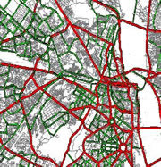
We have a range of city level GIs data sets. Our GIS map data product includes all Metros and major cities of India like Delhi, Mumbai, Kolkata, Bangalore, Chennai, Hyderabad and Pune, Ahmadabad etc. Our City data set Map data contains Layers as following.


Layers Sub- Layers
  • Administrative layers.
City Boundary
    • Ward Boundary
    • Locality and sub-Locality Boundary
    • Postal Code Boundary.
   
  • Transportation Layers.
    • National & Express Highway.
    • State Highway, District Highways.
    • Major roads   - Arterial roads.
 
    • Minor roads   - Collector roads, &
    • Residential roads.
.
  • Railway Lines
   
  • Land marks (POI).
 
   
Other Layers
    • like Water Areas and Green etc.


Map Data is Available in Multiple formats like Esri Shape files, MapInfo TAB, MID/MIF and other formats.

    1.  


Our Clients are

Transport Sector Telecommunication Sector Utility Sector Car Navigation Retail Sector Real Estate Sector

Services Overview

We provide digital and High Quality India GIS map data on very low and affordable price. Our mission is to provide on time Quality services to our clients. Following are some of our servicess

  • GIS data development & Management
  • GIS Application Develpment
  • GIS other servicess

Contact Us

If you have any Question. comments, feedback and suggetionss regarding our products, servicess please do not hessitate to write us on

Address: Karnataka, INDIA
Skype:gismaps.in
Gtalk:gismaps.in
E-mail: mapsgis@gismaps.in